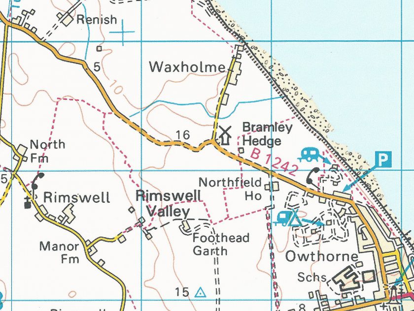
I am aware that my latest blog post may be a little controversial, but before anyone rushes to condemn it out-of-hand, please either obtain an OS Explorer map of East Yorkshire (292), or use the StreetMap I’ve included on this blog. From this you should be able to see that what is now the B1242 heads from Thirtle Bridge in the top left hand corner of the map south-east down towards Withernsea. Edith’s lodgings are in the bottom right-hand corner of the map. The proximity of the massive white structure of Withernsea Lighthouse to Edith’s lodgings is evident on the map.
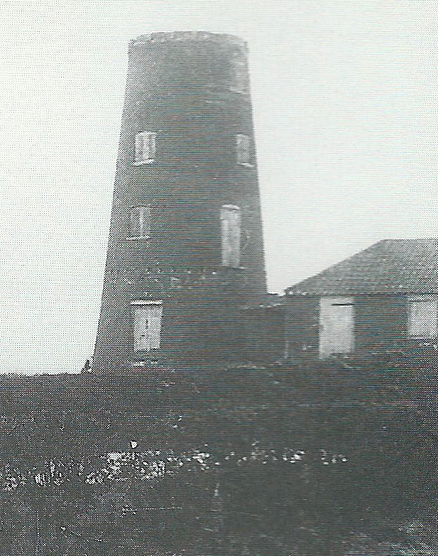
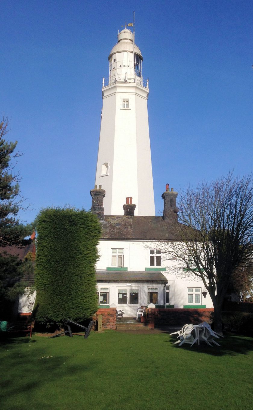
About halfway between Thirtle Bridge and Withernsea in 1917 was a stark black old mill being used as an army watch-tower, at which was situated a military checkpoint. My blog tries to give an idea of how these two structures would look to anyone travelling along that road during WW1. Tolkien would have to use that route every time he visited Edith, while she was lodged in Withernsea, but also on each occasion he had to catch a train in Withernsea for medical examinations in Hull. As far as I know this is the only example of Tolkien having to travel past a dark tower towards a white one during wartime in a relatively bare landscape. I’m not saying that these must be the Two Towers of his book title, but they are worth considering as more suitable candidates than others which have been suggested in the past.
To make up your own minds by reviewing all the evidence, please visit my personal blog.